Updating Mapping for Wollondilly Flood Study
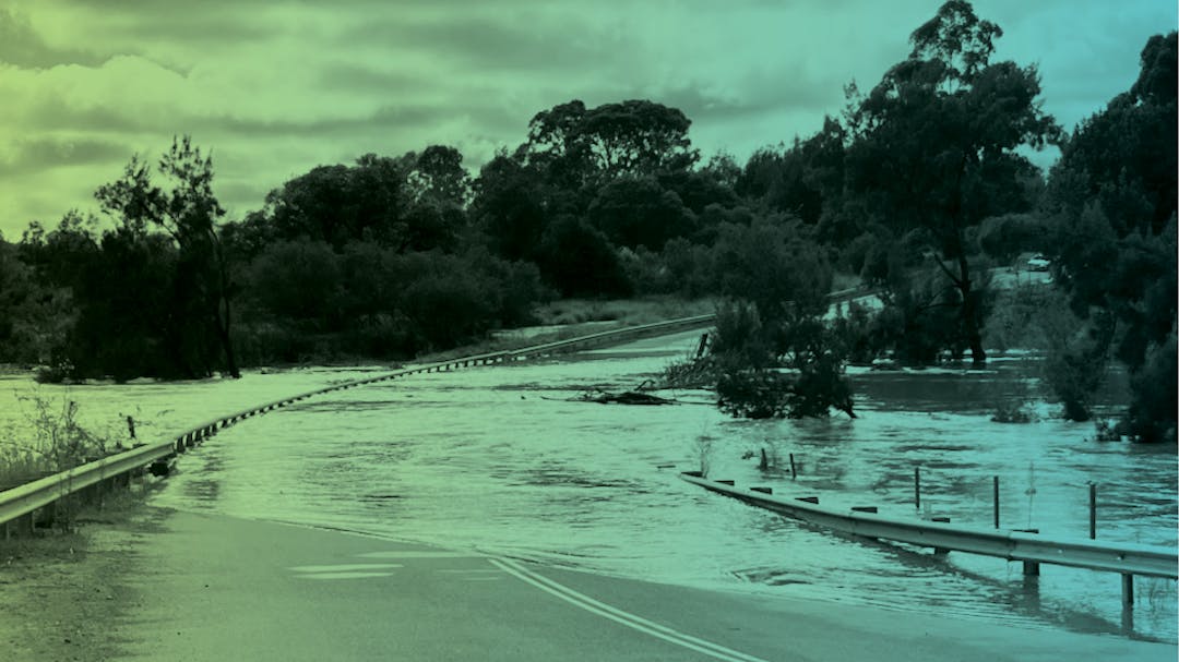
Wollondilly Shire Council is continuing work on flood mapping across the Shire.
A flood study is an important step towards developing a Flood Risk Management Study and Plan. A Flood Risk Management Plan establishes the best actions Council can undertake to improve the situation and to help reduce the worst effects of flooding – whether overland flooding or mainstream flooding. Before we start the Flood Risk Management Plan, we need accurate mapping.
In 2024 we checked in to see if the draft mapping aligned with people’s observations and lived experience. Thank you to everyone who provided feedback – it is helping to verify and adjust our mapping.
All Councils in NSW are undertaking flood studies and flood risk management plans to fulfil NSW Government requirements.
Broad Scale Mapping
The broad scale study ranges from Warragamba and Silverdale to Yanderra, and from Nattai to Appin, and uses the latest topographic data and modelling techniques as well as local knowledge in an effort to better understand the nature and extent of flooding across Wollondilly Shire.
The draft broad scale mapping includes:
- Flood extent and depth mapping of 1 in 10 chance flood, 1 in 100 chance flood, and 1 in 500 chance floods
- Flood Planning Area (FPA) mapping based on the 1 in 100 chance flood that is used for assessing development
- Probable Maximum Flood (PMF) mapping to show the biggest possible flood
- Distinction between Flood Planning Areas for overland flooding (runoff) and mainstream (riverine) Flooding.
Detailed Mapping in Villages and Towns
We have also taken a closer look at specific villages and are working on versions of more detailed flood mapping for Appin, The Oaks, Tahmoor, Thirlmere, South Picton, Warragamba, Silverdale, Bargo and Yanderra. This mapping:
- Is more detailed than the broad scale mapping
- Sets us up well for considering Flood Risk Management options.
Consultation
Two previous consultations helped with drafting the flood mapping. During our most recent consultation period in 2024, we asked to hear feedback about whether our draft mapping matched community observations and understanding of flooding and water flow in local areas, especially in relation to the 1 in 10 chance flood mapping.
We collected a large amount of feedback from the Your Say Wollondilly feedback form, the interactive map, phone calls, emails, and conversations at our drop-in sessions. We continue to work through this information.
Understanding Risk Helps Manage Risk
The process of doing a flood study helps Council and the community understand flood risk. It’s important to note that the study assesses existing flood risk. It doesn’t change a property’s flood risk – it evaluates existing risk.
All Councils in NSW are undertaking flood studies and flood risk management plans to fulfil NSW Government requirements under the NSW Flood Prone Land Policy. Council has engaged consultants Worley Consulting (previously called Advisian) to carry out the Flood Study.
Thank you to everyone who provided input regarding Stonequarry Creek. The draft Wollondilly Flood Study builds on the adopted Stonequarry Creek Floodplain Risk Management Plan, with a range of actions now underway or already delivered to help address flooding for Picton.
Useful Information


Videos
-
This video explains some of the terminology used within the Wollondilly Flood Study.
-
This video provides a screen shots of how to use Council's Public Mapping System - Intramaps