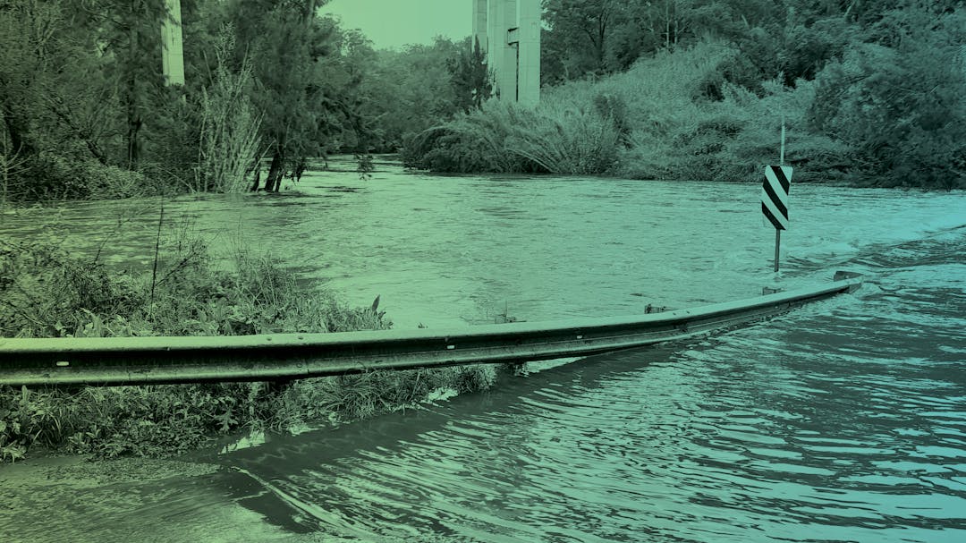
Wollondilly Flood Study

Photo of Douglas Park causeway underwater during a flood, with the freeway bridge legs in the background


It’s more important than ever to be aware of flood risks where you live.

We are continuing work on our flood studies and checking in with the community again to verify that our modelling reflects lived experience. Thank you to everyone who has provided input in the previous two rounds of consultation – it has helped in verifying our mapping.

The broad scale study ranges from Warragamba and Silverdale to Yanderra, and from Nattai to Appin, and uses the latest topographic data and modelling techniques as well as local knowledge in an effort to better understand the nature and extent of flooding across Wollondilly Shire.

Coming Soon

We’ll soon be seeking additional feedback on the broad scale study that was previously publicly exhibited – it has been updated, with:

  • New Probable Maximum Flood (PMF) mapping
  • New Flood Planning Area (FPA) mapping based on 1% AEP flood (1% chance of occurring in any given year)
  • Distinction between Flood Planning Areas for Overland (Flash) Flooding and Riverine (Mainstream) Flooding.

We have also taken a detailed look at specific villages and will have new versions of more precise flood mapping for Appin, The Oaks, Tahmoor, Thirlmere, South Picton, Warragamba, Silverdale, Bargo and Yanderra. This mapping:

  • Is more detailed than the broad scale mapping
  • Sets us up well for considering Flood Risk Management options.

You will have the opportunity to view online mapping, add your observations to an interactive map tool, to provide feedback on our online feedback form, call for a chat, and see us in person.

Drop-in Sessions

We will be holding a series of drop-in sessions around the Shire for the community to find out more about the flood mapping, ask questions, and provide feedback about what the mapping shows. Does the mapping match where you’ve seen (or heard of) flooding in the time you’ve lived in Wollondilly?

  • Wednesday 8 May at Tahmoor Sporting Complex from 4:00-7:00pm
  • Thursday 9 May at The Oaks Community Hall from 4:00-7:00pm
  • Saturday 11 May at Tahmoor Sporting Complex from 9:00am-12:00pm
  • Wednesday 15 May at Yanderra Public School from 4:00-7:00pm
  • Monday 20 May at Appin AIS Community Hall from 4:00-7:00pm
  • Wednesday 29 May at Warragamba Town Hall (Seniors Annex) from 4:00-7:00pm
  • Thursday 30 May at Douglas Park Community Centre from 4:00-7:00pm
  • Wednesday 5 June at Bargo Community Hall from 12:00-3:00pm

Understanding Risk Helps Manage Risk

The process of doing a flood study helps Council and the community understand flood risk. It’s important to note that the study assesses existing flood risk. It doesn’t change a property’s flood risk – it evaluates existing risk.

The studies use two models.

  • One model assesses rainfall and runoff (the water that flows downhill rather than being absorbed).
  • A second model – of the terrain – shows us where the water flows and analyses how it flows over the ground, in terms of depth and speed.

This analysis produces a series of flood maps.

We expect consultation to be open before the end of April and thank you for your patience.